Historical photos of the San Fernando Valley
From the 1930s to 1975, here are some historical photos of the San Fernando Valley.
![Members of the Wood family pick flowers at their small farm home in the San Fernando Valley in 1935.](https://ca-times.brightspotcdn.com/dims4/default/81cbc4f/2147483647/strip/true/crop/750x593+0+0/resize/750x593!/quality/75/?url=https%3A%2F%2Fcalifornia-times-brightspot.s3.amazonaws.com%2F28%2Fc8%2F516ed6864f3883be12f564b989cd%2Fpicking-flowers-1935.jpg)
Members of the Wood family pick flowers outside their small farm home in the San Fernando Valley in 1935. (Los Angeles Times archive / UCLA Library)
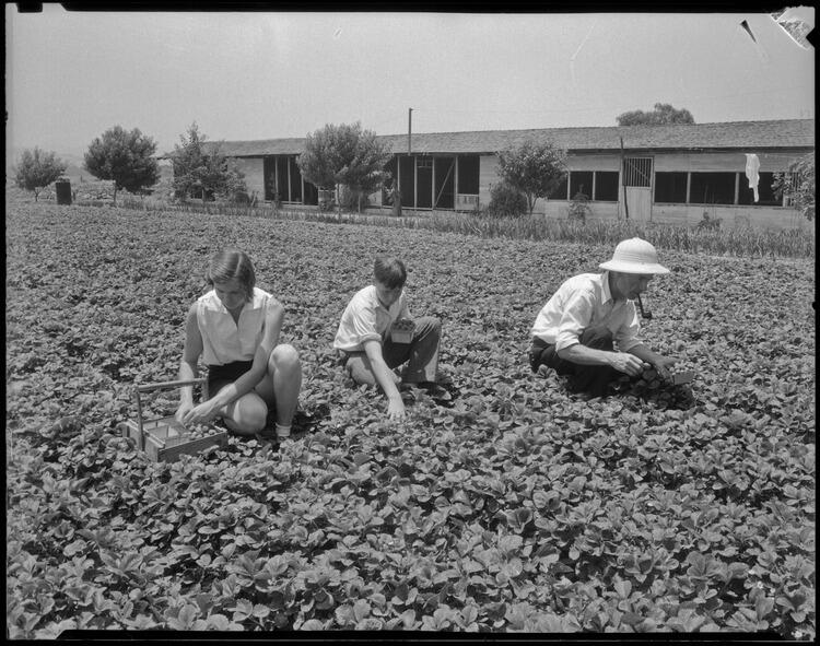
![A family picks strawberries on their San Fernando Valley farm in 1935.](https://ca-times.brightspotcdn.com/dims4/default/4532a2e/2147483647/strip/true/crop/750x591+0+0/resize/750x591!/quality/75/?url=https%3A%2F%2Fcalifornia-times-brightspot.s3.amazonaws.com%2Fb2%2F98%2F190614374504b5af78d883ebee12%2Fstrawberry-farm-1935.jpg)
Members of the Wood family pick strawberries on their small farm in the San Fernando Valley in 1935. (Los Angeles Times archive / UCLA Library)
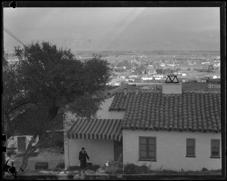
![A woman stands outside a Sherman Oaks home in 1934.](https://ca-times.brightspotcdn.com/dims4/default/4393ff3/2147483647/strip/true/crop/750x598+0+0/resize/750x598!/quality/75/?url=https%3A%2F%2Fcalifornia-times-brightspot.s3.amazonaws.com%2F03%2Fc3%2Fbed90bb04f4588de128a483f510e%2Fsherman-oaks-home.jpg)
A woman stands outside a home in the hills of Sherman Oaks in 1934. There is sparse development in the background. (Los Angeles Times archive / UCLA Library)
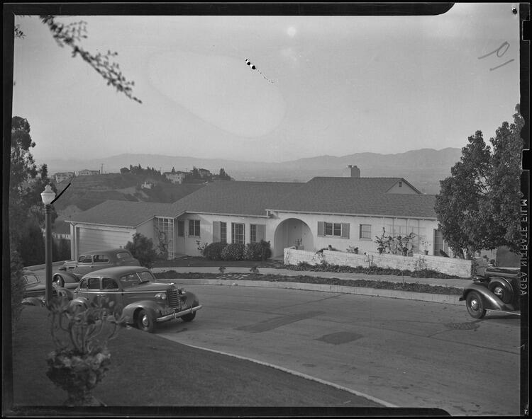
![A Hollywood Hills home is shown in 1938.](https://ca-times.brightspotcdn.com/dims4/default/af1d83d/2147483647/strip/true/crop/750x592+0+0/resize/750x592!/quality/75/?url=https%3A%2F%2Fcalifornia-times-brightspot.s3.amazonaws.com%2Fcd%2Faf%2F6d5d56a7462f99afffaf8458898e%2Fhollywood-hills-home-1938.jpg)
Singer Ruth Etting’s Hollywood Hills home on Lake Hollywood Drive is shown in 1938. The San Fernando Valley is visible in the distance. (Los Angeles Times archive / UCLA Library)
Advertisement
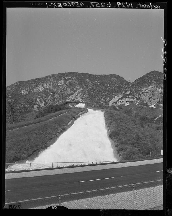
![The Cascades](https://ca-times.brightspotcdn.com/dims4/default/a46eef0/2147483647/strip/true/crop/599x750+0+0/resize/599x750!/quality/75/?url=https%3A%2F%2Fcalifornia-times-brightspot.s3.amazonaws.com%2F46%2F70%2F182282654105b377e4042b9966ef%2Fcascades.jpg)
The Cascades, a Los Angeles Department of Water and Power project that tumbles beneath Foothill Boulevard and the Golden State Freeway beyond San Fernando, is shown in 1956. Water from the Owens River flows to the terminus of the 233-mile Owens River Aqueduct. (Los Angeles Times archive / UCLA Library)
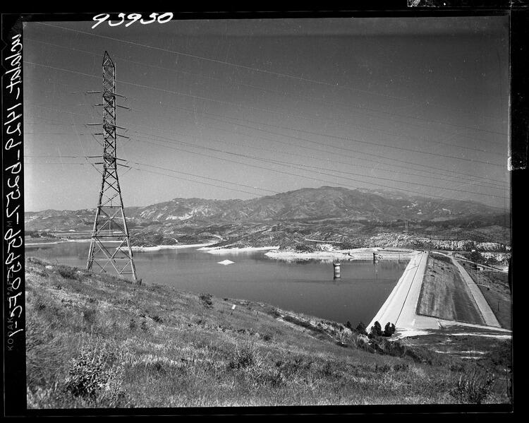
![Upper Van Norman Lake](https://ca-times.brightspotcdn.com/dims4/default/1cc4423/2147483647/strip/true/crop/750x599+0+0/resize/750x599!/quality/75/?url=https%3A%2F%2Fcalifornia-times-brightspot.s3.amazonaws.com%2Fd4%2F6d%2F6888550c444083007caedbff3988%2Fupper-van-norman-lake.jpg)
The Los Angeles Department of Water and Power used Upper Van Norman Lake, shown in 1956, as a storage place for Owens River water, which arrived via a 233-mile aqueduct. It is adjacent to Sepulveda Boulevard in Granada Hills, in the northwest corner of the San Fernando Valley. The lake and a nearby reservoir are named for H.A. Van Norman, a general manager of the DWP who played a leading role in construction of the Owens River Aqueduct. (Los Angeles Times archive / UCLA Library)
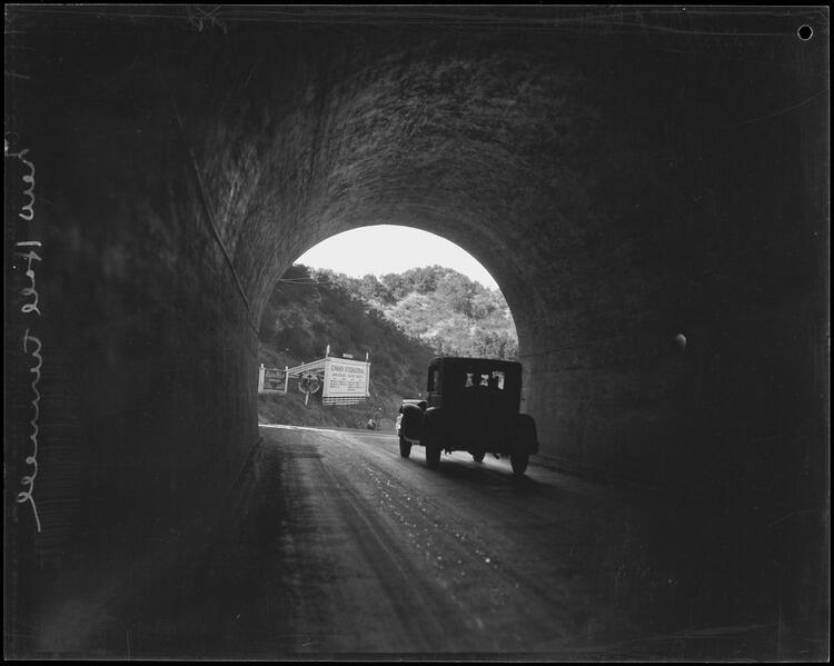
![Newhall Tunnel in 1928](https://ca-times.brightspotcdn.com/dims4/default/b667355/2147483647/strip/true/crop/750x599+0+0/resize/750x599!/quality/75/?url=https%3A%2F%2Fcalifornia-times-brightspot.s3.amazonaws.com%2F50%2Ff4%2F6bfe2d5a4524a75b169aac294b02%2Fnewhall-tunnel-4-1928.jpg)
The Newhall Tunnel, shown in 1928, connects the San Fernando and Santa Clarita valleys. (Los Angeles Times archive / UCLA Library)
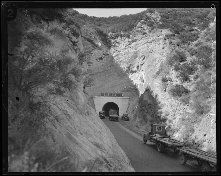
![Newhall Tunnel in 1928](https://ca-times.brightspotcdn.com/dims4/default/8857d57/2147483647/strip/true/crop/750x598+0+0/resize/750x598!/quality/75/?url=https%3A%2F%2Fcalifornia-times-brightspot.s3.amazonaws.com%2Ffc%2F28%2F0834783948c894a3d5d114a139e9%2Fnewhall-tunnel-2-1928.jpg)
A 1928 image shows the roadway leading to the Newhall Tunnel. (Los Angeles Times archive / UCLA Library)
Advertisement
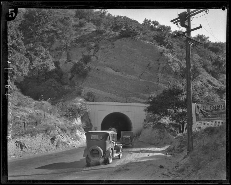
![Newhall Tunnel in 1928](https://ca-times.brightspotcdn.com/dims4/default/dd33f89/2147483647/strip/true/crop/750x600+0+0/resize/750x600!/quality/75/?url=https%3A%2F%2Fcalifornia-times-brightspot.s3.amazonaws.com%2F65%2F87%2F0e0e63d64e1a8143306b4e3bc126%2Fnewhall-tunnel-3-1928.jpg)
Another view of the Newhall Tunnel from 1928 is shown. (Los Angeles Times archive / UCLA Library)
![Newhall Tunnel in 1928](https://ca-times.brightspotcdn.com/dims4/default/30a99c5/2147483647/strip/true/crop/750x605+0+0/resize/750x605!/quality/75/?url=https%3A%2F%2Fcalifornia-times-brightspot.s3.amazonaws.com%2F49%2F41%2F59e715244578935d5594ffee1a48%2Fnewhall-tunnel-1-1928.jpg)
The Newhall Tunnel, shown in 1928, cuts through Newhall Pass. (Los Angeles Times archive / UCLA Library)
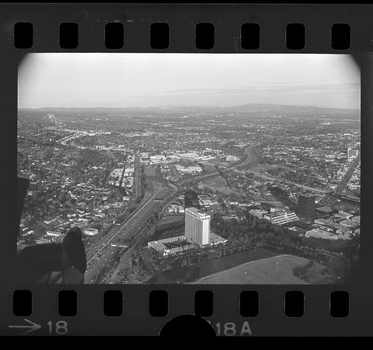
![An aerial view of the San Fernando Valley from 1975](https://ca-times.brightspotcdn.com/dims4/default/1293c12/2147483647/strip/true/crop/750x704+0+0/resize/750x704!/quality/75/?url=https%3A%2F%2Fcalifornia-times-brightspot.s3.amazonaws.com%2F3e%2Fea%2F63a01ea84a57b9334b035a37b573%2Fsfv-aerial-1975.jpg)
An aerial image takes in the Cahuenga Pass in the San Fernando Valley in January 1975. In the foreground, the Sheraton-Universal hotel can be seen beside the Hollywood Freeway. (Art Rogers / Los Angeles Times archive / UCLA Library)